Discover how Ordnance Survey helps you plan, navigate, and explore with confidence in our blog post, “Ordnance Survey: Mapping Your Journey, Your Way.” This guide breaks down how Ordnance Survey combines trusted mapping expertise with modern digital tools to support outdoor adventures, business planning, and everyday navigation. Learn about OS Maps, data services, map types, and why Ordnance Survey remains the gold standard for accurate and reliable mapping in the UK.
Ordnance Survey: Mapping Your Journey, Your Way
Imagine having the power to explore breathtaking landscapes, navigate unfamiliar terrain, or plan logistics for an expedition with pinpoint accuracy — that’s the magic of Ordnance Survey (OS). For over two centuries, OS has been charting landscapes, solving geographical puzzles, and equipping adventurers, planners, developers, and everyday explorers with tools that transform maps into journeys. From classic paper maps to cutting-edge digital mapping platforms, OS helps you take control of your journey — your way.
What Is Ordnance Survey?
At its core, Ordnance Survey is Great Britain’s national mapping agency — an institution dedicated to creating detailed and trusted maps of the nation’s terrain. While many people use maps on their phones without a second thought, OS is the name behind the precision and structure of those maps, offering unrivalled details that both professionals and casual adventurers rely on.
A Brief History of Britain’s National Mapping Service
The roots of Ordnance Survey stretch back to the late 1700s when accurate maps were needed to defend the country and help military operations. From this military origin grew an institution dedicated to charting the British landscape with precision. Over time, OS evolved into a civilian agency, transforming mapping from sketches and compasses into modern geography and spatial intelligence.
From Military Origins to Modern Mapping
Today, OS is not just about paper maps. While it still produces iconic printed maps beloved by hikers and outdoor enthusiasts, OS’s remit extends far beyond. Licensed as a government-owned company, OS now focuses on digital mapping tools, geospatial data platforms, and applications designed for mobile and desktop use. Whether you are plotting a walking route or planning a new housing development, OS provides the backbone of geographic insight.
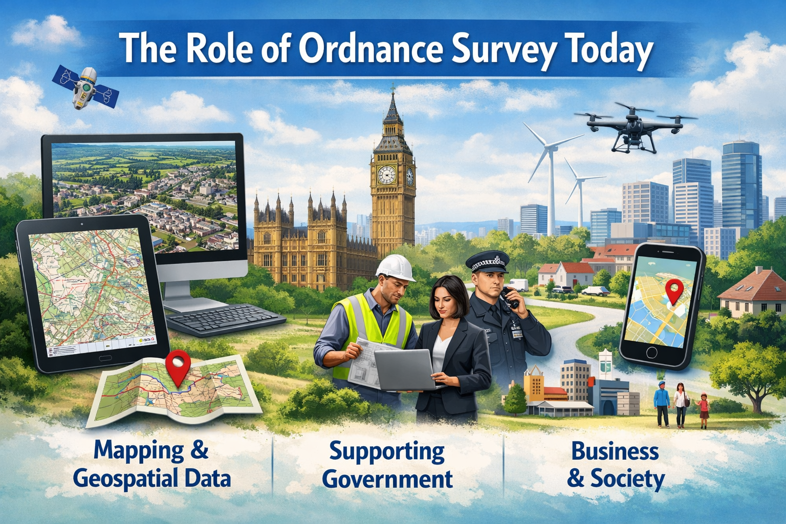
The Role of Ordnance Survey Today
In a world where location matters — from planning infrastructure to saving a life in an emergency — OS plays a key role. Its National Geographic Database is one of the most detailed representations of Great Britain’s landscape, with over 600 million features that are updated daily.
National Geographic Database
The OS’s National Geographic Database (NGD) is more than a map — it’s a living dataset. Surveyors on the ground and remote sensing technologies combine to capture physical changes in the land, from new buildings to shifting roadways. This data keeps the maps current and meaningful, providing a foundation for planning, transportation, environmental analysis, and much more.
Supporting Government, Business, and Society
OS products don’t just help explorers; they are integral to critical planning decisions across government and industry. From supporting emergency services and housing policy to helping businesses optimise deliveries and asset management, OS data is woven into the fabric of British infrastructure.
OS Maps — A Tool for Everyone
One of OS’s standout offerings is OS Maps — a flexible platform that blends classic cartography with modern tech. Whether you want to plot a cross-country trek, find a hidden footpath, or simply explore your local park, OS Maps makes it intuitive.
OS Maps for Outdoor Adventures
With millions of routes to explore and tools that let you plot your own journeys, OS Maps puts the landscape at your fingertips. It blends topographic details — hills, contours, footpaths — with practical tools for route planning and distance measurement.
OS Maps Online and Mobile
Flexibility is key. OS Maps works seamlessly on web browsers and mobile devices, with offline access available so that you’re never lost even when you lose signal. Whether you’re walking in the Lake District or cycling along coastal paths, OS Maps helps you plan and track your routes with confidence.
How OS Makes Your Journey Easier
What sets OS apart from generic mapping solutions is its deep accuracy and attention to detail. With grid references, topographical data, carefully curated symbols, and scales that help you visualize the real world, OS invites users to think like a navigator.
Planning and Navigation
Whether you’re heading into the wilderness or navigating a city, knowing exactly where you are — and where you’re going — is invaluable. OS maps include grid references that help pinpoint locations and explain symbols that bring the landscape to life.
Real-Time, Accurate Geospatial Data
Behind the scenes, OS’s massive dataset is constantly updated with real-world changes. This means that when you open an OS map, you’re getting the most accurate depiction of the landscape possible — whether roads have changed or new paths have appeared.
Understanding OS Map Types and Scales
Maps aren’t one-size-fits-all — and OS understands this better than most. OS offers maps at varying scales to fit the needs of different journeys.
Large-Scale vs Small-Scale Maps
Large-scale maps (e.g., 1:2,500) show fine detail — ideal for land-use planning or urban surveys. Smaller scales (e.g., 1:50,000) cover broader areas, perfect for recreational use like hiking or cycling.
Common OS Map Series Explained
Two popular series are the Explorer (1:25,000 scale) and Landranger (1:50,000 scale), beloved by hikers for their balance of detail and coverage. These series let users visualize terrain, paths, and points of interest across Great Britain.
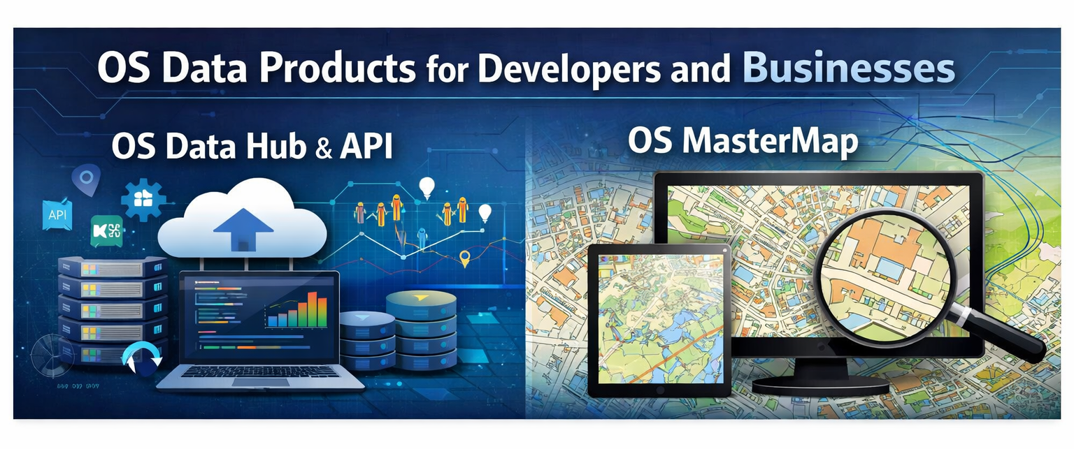
OS Data Products for Developers and Businesses
OS isn’t just for walkers and planners — developers use OS data to build apps, enhance services, and power analytics tools.
OS Data Hub and API
The OS Data Hub allows developers to access a suite of APIs and data services. Whether you’re building a routing app or analysing demographic trends, the Data Hub brings geospatial info straight into your project.
OS MasterMap
One of OS’s flagship digital products is OS MasterMap — a comprehensive digital base map that records every fixed feature in Great Britain and gives each feature a unique identifier. It’s a foundational tool for advanced geographical analysis and highly detailed mapping.
Education and Community Tools
OS also supports learning and community engagement. Tools like MapZone bring geography to life for students, while public resources help people explore the science behind maps and navigation.
MapZone and Teaching Resources
MapZone and other education resources help teachers and learners dive into the world of maps, terrain, and exploration with interactive and engaging tools.
Community Mapping Projects
Community-driven initiatives allow users to share routes and experiences, blending local knowledge with OS’s trusted data. These projects encourage people to discover new paths and enjoy Britain’s landscapes together.
The Future of Mapping with OS
OS isn’t standing still. With digital transformation and ever-improving tech, the future of mapping is interactive, accessible, and more exciting than ever.
Innovation and Digital Transformation
New apps, cloud data services, and integration with other platforms mean OS maps are becoming smarter and more responsive to how users explore the world.
Encouraging Outdoor Exploration
With trends showing growing interest in outdoor activities, OS is using its tools to inspire more people to get outside and enjoy nature — whether walking, cycling, or exploring cultural sites.
Why OS Maps Still Matter in the Digital Age
In an era of fast, turn-by-turn GPS, you might wonder: why do traditional maps still matter? OS maps combine accuracy, context, and depth in ways that simple digital maps can’t match.
Accuracy and Trust
Builders, planners, emergency responders, and explorers rely on OS maps because they are official, vetted, and constantly updated.
Inspiration for Every Journey
OS maps don’t just tell you where you are — they spark curiosity about what’s around you. Whether revealing hidden footpaths or helping you plan your next adventure, these maps turn journeys into stories.
Tips for Using OS Maps Like a Pro
If you’re diving into OS mapping for the first time:
- Learn how to read grid references and map scales.
- Use OS Maps on your phone with offline downloads before setting off.
- Pair digital maps with physical ones for confidence in challenging terrain.
- Explore OS education resources to sharpen your navigation skills.
Conclusion
Ordnance Survey is far more than a mapping agency — it’s the backbone of how Great Britain understands and navigates its landscape. From detailed paper maps trusted by generations of hikers to powerful digital platforms like OS Maps and advanced geospatial data services for businesses, Ordnance Survey continues to evolve while maintaining the accuracy and reliability it’s known for. Whether you’re planning a countryside walk, building a logistics network, or developing location-based technology, OS provides the tools to move forward with confidence.
Frequently Asked Questions